
Blog
Travel Scavenger Hunt: Around the World in 8 Geography Challenges for a Global Birthday Party
Last updated: April 2026 | Written by Arne, founder of Riddlelicious
About this guide: The geography hunt format uses real navigational tools and cultural knowledge — latitude/longitude coordinates, flag symbolism, time zone calculation, and culinary geography — not just “name the capital.” Each station teaches a skill that actual travelers and geographers use. Kids who complete this hunt have genuinely practiced reading coordinates, interpreting flag design, and calculating time differences across hemispheres.
The most interesting thing about geography isn’t memorizing capitals — it’s understanding why countries look the way they do. Why is Australia’s flag different from New Zealand’s? What does a country’s shape tell you about its history? Why do 11 countries in Africa have red, yellow, and green in their flag?
The World Geography Bureau frames the party as a global intelligence operation: each kid is a Field Correspondent who has been temporarily stranded in 8 different countries. They must use geographical skills to navigate home — reading coordinates, decoding flag messages, calculating time zones, and identifying cultures from food and landmarks.
Quick Facts
- Ages: 7–12
- Players: 4–20 (correspondent teams of 3–4)
- Duration: 80–95 minutes
- Location: Indoor — map-based stations
- Equipment: World map, printed flags, globe (or atlas), calculator
- Geography skills: Coordinates, flag symbolism, time zones, physical features, cultural geography

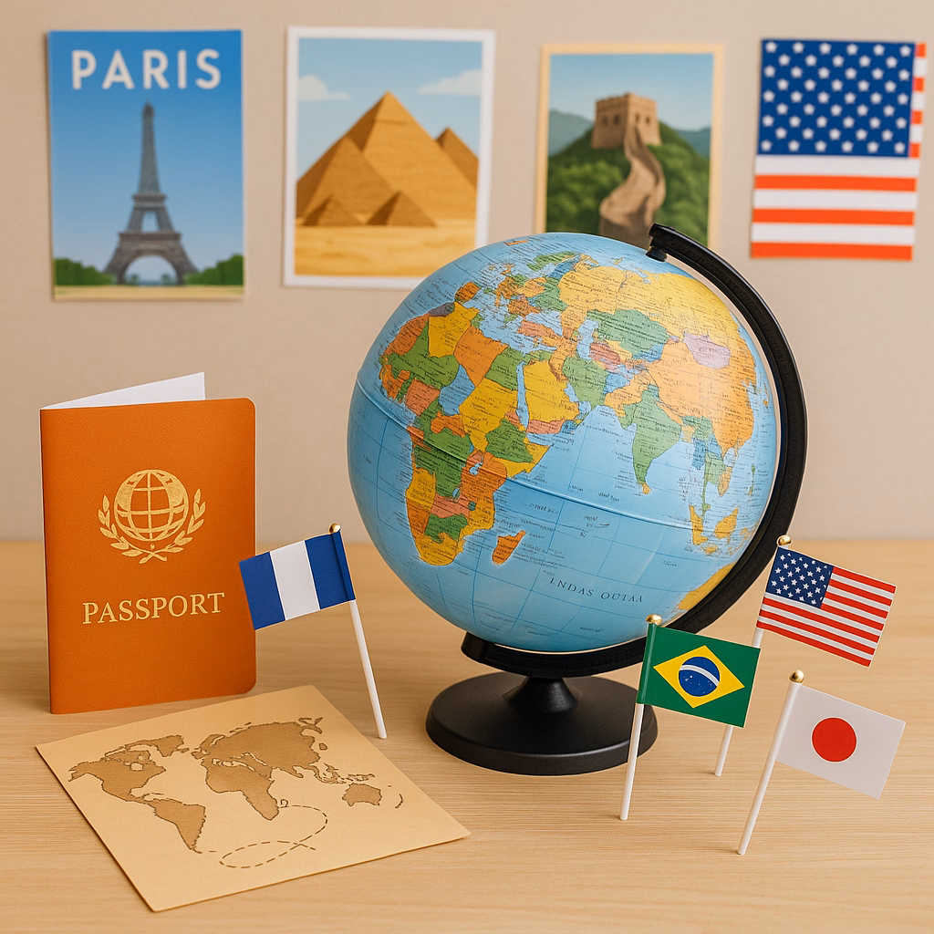
The World Geography Bureau Setup
Each team receives a Correspondent’s Passport: a folded paper booklet with their team designation (Bureau Unit Alpha, Beta, Gamma), a world map on the cover, and one “country stamp” page per station. Each completed station earns a passport stamp (a simple ink stamp or sticker in the correct flag colors). A fully stamped passport earns Senior Correspondent status.
Hang a large world map (available for free print from naturalearthdata.com or just use a poster) as the central reference. Teams are encouraged to use it at any station — using a reference is what real geographers do.

Take the Adventure to Ancient Egypt
Our Egypt Scavenger Hunt adds a deep archaeological dimension to any geography-themed party — 8 station cards covering Egyptian culture, hieroglyphics, and archaeology. Instant download.
The 8 Geography Stations
Coordinates Mission — Locate 6 Cities
Skill: Latitude and longitude — the global coordinate system
Every location on Earth is defined by two numbers: latitude (distance north or south of the equator, 0°–90°) and longitude (distance east or west of the Prime Meridian, 0°–180°). GPS, aviation, and maritime navigation all run on this system. Knowing how to read coordinates is the foundational skill of all navigation.
Task: Provide 6 sets of coordinates (e.g., 48.8566° N, 2.3522° E). Teams use a world map with a coordinate grid to identify the city at each location. Good choices: cities on different continents with easily recognizable positions — Paris, Sydney, Cairo, Rio de Janeiro, Tokyo, New York.
Score: 2 points per city identified correctly + 1 per continent correctly named. Max 18 points.
Flag Intelligence — Decode the Symbols
Skill: Vexillology — the study of flag design and symbolism
Every flag element has meaning. Red typically represents blood/sacrifice or revolution. Blue represents sea, sky, or loyalty. A crescent and star = Islamic heritage. A Union Jack in the corner = former British colony. A sun = agricultural heritage or a specific historical figure. Flag design is a compressed national narrative.
Task: Display 10 national flags (printed, no labels). Teams identify each country and explain one symbol element’s meaning using a provided Vexillology Reference Card. Bonus: identify which 3 flags are most similar and explain why (historical connection, same designer, or colonial relationship).
A good 10-flag set for diversity: USA, Canada, Australia, Jamaica, Saudi Arabia, South Africa, Japan, Brazil, Norway, India.
Time Zone Calculator
Skill: Time zones — Earth’s 24-hour rotation and the International Date Line
Earth rotates 360° in 24 hours = 15° per hour. The world is divided into 24 primary time zones, each roughly 15° of longitude wide. When it’s noon in New York (UTC-5), it’s 6pm in London (UTC+1) and 2am the next day in Tokyo (UTC+9). The International Date Line at 180° longitude is where the date changes.
Task: Give teams a Time Zone Reference Map and 6 mission scenarios: “It’s 3pm in Los Angeles. What time is it in: (a) London? (b) Mumbai? (c) Sydney? (d) Rio de Janeiro?” Teams calculate each answer using the UTC offset system. Bonus: which two of the given cities are closest in local time to each other despite being on opposite sides of the world?
Scoring: 1 point per correct calculation. Max 6 points + 2 bonus.

Physical Features — Landmark Identification
Skill: Physical geography — landform and biome recognition
Earth’s surface features tell stories: mountain ranges form where tectonic plates collide, river deltas form where sediment deposits, deserts form on the leeward side of mountain ranges (rain shadows). Recognizing these features from maps and photographs is the foundation of physical geography.
Task: Display 12 photograph cards — a mix of biomes (tundra, rainforest, savanna, desert, temperate forest, coral reef) and landforms (delta, fjord, mesa, volcano, atoll, glacier). Teams sort them into categories using a reference guide, then match 6 specific examples to their continent and country on the world map.
Culinary Geography — Taste the Map
Skill: Cultural geography — food as a geographic indicator
Food ingredients are geographic indicators. Saffron grows only in specific climates (Iran produces 90% of the world supply). Chocolate originates in Mesoamerica. Pasta’s spread through Europe tracks trade routes. A trained food archaeologist can estimate when a recipe originated and how it traveled by analyzing the ingredients.
Task: Set out 8 small food samples, each labeled only with its primary ingredient. Teams must identify which continent each ingredient originated from using a Crop Origin Reference Card. Include: rice (Asia), chocolate (Mesoamerica), coffee (Ethiopia), potato (Andes), tomato (Mexico), olive oil (Mediterranean), vanilla (Mexico), tea (China).
Bonus: which of these ingredients is now most widely produced outside its origin continent? (Coffee — Brazil produces more than Ethiopia.)
Language Map — Script Recognition
Skill: Linguistic geography — identifying language families by script
There are approximately 7,000 languages spoken on Earth, using about 30 different writing systems. Latin script (used by English, Spanish, French, German) is the most widespread. Other major scripts: Cyrillic (Russian, Bulgarian), Arabic, Hebrew, Hindi Devanagari, Chinese/Japanese/Korean, Thai, Georgian.
Task: Print 8 short phrases, each written in a different script (no translation given). Teams must identify the script family and name one country that uses it. Provide a Script Reference Card with 10 script samples labeled by language family. Bonus: arrange the 8 scripts in order of estimated number of speakers.
Border History — Why Countries Have These Shapes
Skill: Political geography — how borders form and change
Most African borders are straight lines — drawn by European colonial powers at the Berlin Conference (1884–85), dividing the continent without regard for existing ethnic territories. European borders mostly follow rivers, mountain ranges, and historical ethnic boundaries. US state borders alternate between geometric (western states, surveyed lines) and geographic (eastern states, rivers and colonial land grants).
Task: Show 5 country or state silhouettes without labels. Teams must identify each from shape alone (classic geography skill). Then answer: which of these borders was drawn by colonial agreement? Which follows a river? Which follows a mountain range? Provide a Border Formation Key.
Global Summit — Correspondent Report
Task: Each team presents their completed passport to the World Geography Bureau Director (host adult). They present: their most surprising finding from any station, the country they’d most want to visit based on what they learned, and one geographic question they still want answered. Questions get written on a “Future Research” board.
The Bureau Director presents passport stamps for each completed station. The team with the most accurate data across all stations earns “Senior Correspondent” certification.
Award categories: Most Accurate Coordinates | Most Flag Symbols Decoded | Fastest Time Zone Calculator | Best Landmark Identification | Best Final Presentation
Decoration Ideas
- World map tablecloth: Print a large world map on paper and use as the main table covering — kids study it all party long
- Flag garland: A string of small national flags from around the world — available inexpensively at party supply stores
- Passport station: A decorated “Border Control” table where kids receive their Correspondent’s Passport at arrival
- Time zone clock wall: 5 paper clock faces labeled with major world cities showing the current time in each zone
Snacks
- Around the world snack table: 6–8 small dishes representing different continents — pita (Middle East), pretzels (Germany), rice crackers (Japan), plantain chips (Caribbean), biltong or crackers with hummus (Africa), tortilla chips (Mexico)
- Globe cake: A round cake frosted in blue with green continent shapes in buttercream
- Passport cookies: Rectangular cookies with passport-style decoration and the party date as a “stamp”
Age Calibration
Ages 7–8
Focus on flag ID (visual matching), landmark photos (biome matching), and culinary geography (taste + match). Skip time zone calculation — replace with “find the continent” map pointing. Simplify coordinates to just continent identification.
Ages 9–10
Full program as described. Time zone calculation is achievable with the reference map. Flag symbolism research generates genuine interest. Culinary geography taste samples are always the most popular station.
Ages 11–12
Add: calculate the distance between two coordinates using the Haversine formula (simplified), research one border dispute currently active in the news, and identify which food origin countries have changed their primary production regions since 1900.
Add an African Safari Adventure to the Hunt
Our Safari Scavenger Hunt takes the global theme deep into African wildlife — 8 outdoor adventure station cards for ages 5–12. Instant download, print and explore.
Frequently Asked Questions
What if kids don’t know much geography to start?
The Reference Cards at each station are designed to make every task solvable without prior knowledge — this is “look it up” geography, not “memorize it” geography. Kids use the world map, the Vexillology Reference Card, the Time Zone Map, and the Crop Origin Card just like real geographers use their tools. The goal is teaching method, not testing memorized facts.
How do I make the food samples at Station 5 practical?
Small amounts work best — a single chocolate chip, a few grains of rice, a coffee bean (smelled, not tasted), a slice of potato, a small piece of tomato. Many of the items can just be shown as whole ingredients rather than tasted. The identification challenge works whether kids taste or just examine. Check for food allergies before the party and adjust accordingly.
Sources & Further Reading
- National Geographic Society — Geography Education resources (nationalgeographic.org/education)
- FOTW — Flags of the World (crwflags.com) — free flag reference database
- World Atlas — Latitude/longitude finder (worldatlas.com)
- Berlin Conference (1884–85) — Encyclopedia Britannica
- Crop Origins — CGIAR Research Centers (cgiar.org) — crop diversity and origin data